Today, I got to see where the seed of EUREC4A was planted almost ten years ago: the Barbados Cloud Observatory (BCO). With the campaign starting officially in just a couple of days, there was lots of activity there today. However, the scientists working to take observations were very generous and spent time telling me about how each instrument worked and showing me some of the data.
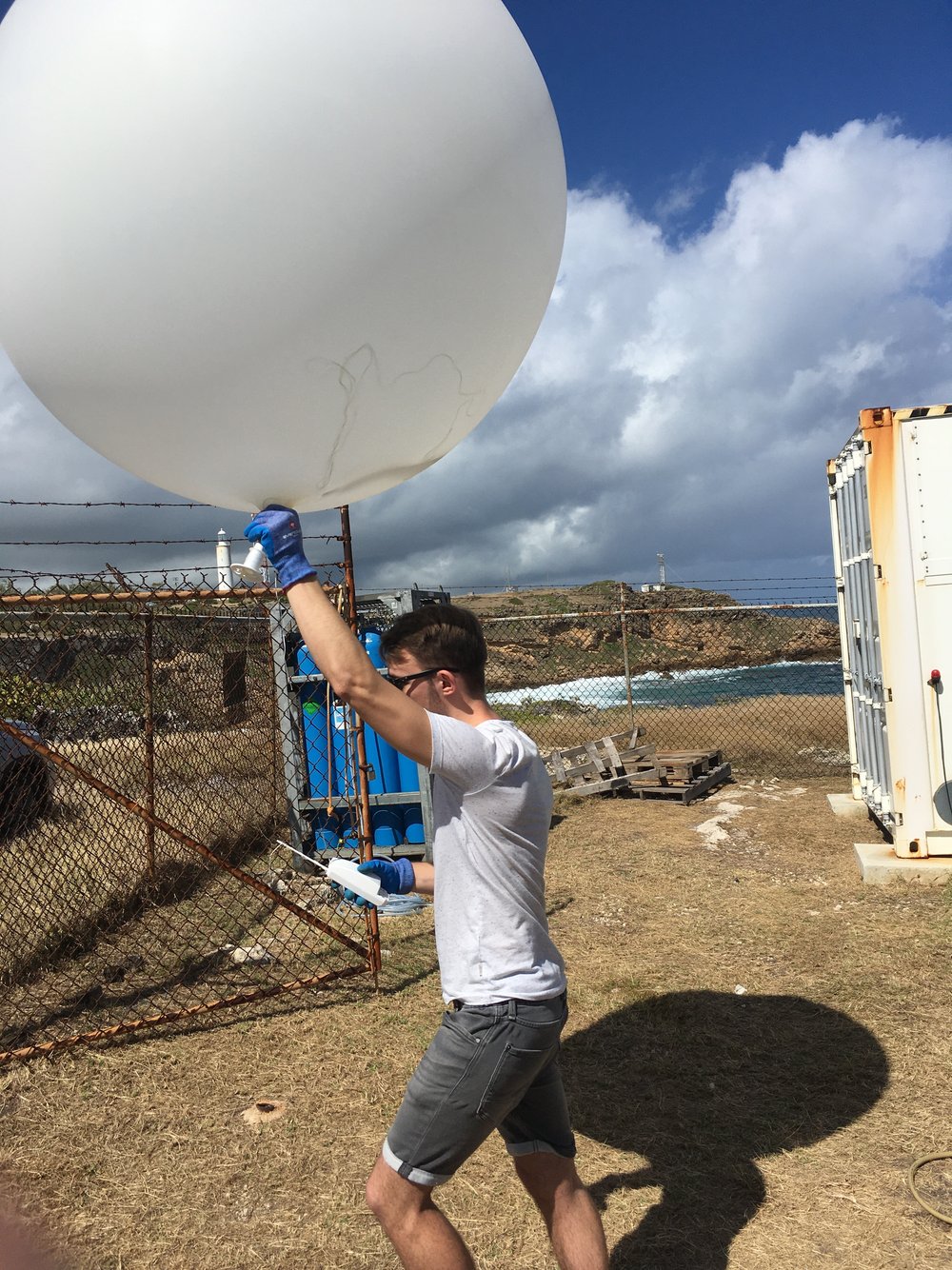
During the campaign, radiosondes (a fancy name for a weather balloon) will be launched every four hours, and I got to watch the first of these regular launches, which was made by Maximilian Ringle, an undergraduate from Hamburg University in Germany. After the launch, I joined the group (pictured below) in watching the radiosonde report the temperature, moisture and winds as it rose through the atmosphere and then descended by parachute after the balloon burst at about 25 kilometers altitude. On the computer screen, you could see the radiosonde move through the layers of the atmosphere, with changes in moisture sometimes accompanied by kinks in the temperature profile that indicate stable layers in the atmosphere. I am planning to make simulations that follow the boundary layer air and clouds as they move toward Barbados, and these profiles will tell us how accurately the simulations reproduce the atmospheric temperature, moisture and winds above Barbados.

Franziska Aemisegger and Leonie Villiger from ETH Zurich installed a Picarro water vapor isotope analyzer at BCO this past week. Today, a second water vapor isotope analyzer made by Los Gator Research was installed. This one comes from Joe Galewsky of the University of New Mexico. The two water vapor isotope analyzers will be operating simultaneously most of the time, so that we can have increased confidence in the signals in the data. This will also allow the the measurements can be continuous, as one instrument will measure the air at BCO while the second can be making its once-per-day calibration using water samples with a known isotopic composition. Last, having two analyzers also allows measurements to continue if one machine has techincal difficulties (which happens more often in the field than in a more controlled laboratory setting). In addition to BCO, water vapor isotope analyzers are aboard three ships (German R/V Meteor, French R/V L'Atalante, US NOAA R/V Ron Brown) and aboard two aircraft (French ATR-42 and the US NOAA P3). We hope to use these to include water isotopes in case studies that follow air masses from over Barbados and BCO. Each day, the group at ETH Zurich computes back trajectories based on the ECMWF forecast system that show the (predicted) origins of air over BCO at different heights. You can see them here:
https://data.iac.ethz.ch/eurec4a/eurec4a_wp_fc_trajs.html
The diversity of locations contributing to the air column over BCO is striking! Franziska helped us look at the trajectories to identify the origins of layers seen in the radiosonde sounding above. The layer between about 2 and 4km, sandwiched between the moist cloud layer and the very dry air above (with RH<5%) seemed to have come from the northern part of South America.
On Friday, I learned about how winds could be measured with lasers. Today, Ilya Seriov of the Max Planck Institute for Meteorology taught me about how lasers (or more properly, a Raman lidar) can observe not only clouds and aerosols, but also the temperature and water vapor content of the atmosphere. Using laser light at three different wavelengths --- 1064, 532 and 355 nanometers (or billionths of a meter) --- the lidar can produce profiles of water vapor and temperature up to the tropopause (around 15 kilometers altitude). While the lidar cannot see through clouds and its signal is diluted by sunlight during the day, this powerful tool can identify not only layers of aerosols (small airborne particles, both natural and anthropogenic) but also the thermodynamic structure of the atmosphere. The continuous observations of the lidar should couple nicely with the less frequent, but higher resolution radiosonde profiles of temperature and moisture. Quick looks from the lidar are automatically generated each day and can be found here:
http://bcoweb.mpimet.mpg.de/quicklooks/lidarql/RamanLidar-CORAL/
Choose low or high resolution and then check out the latest data or your favorite day in the past.

