15 Feb
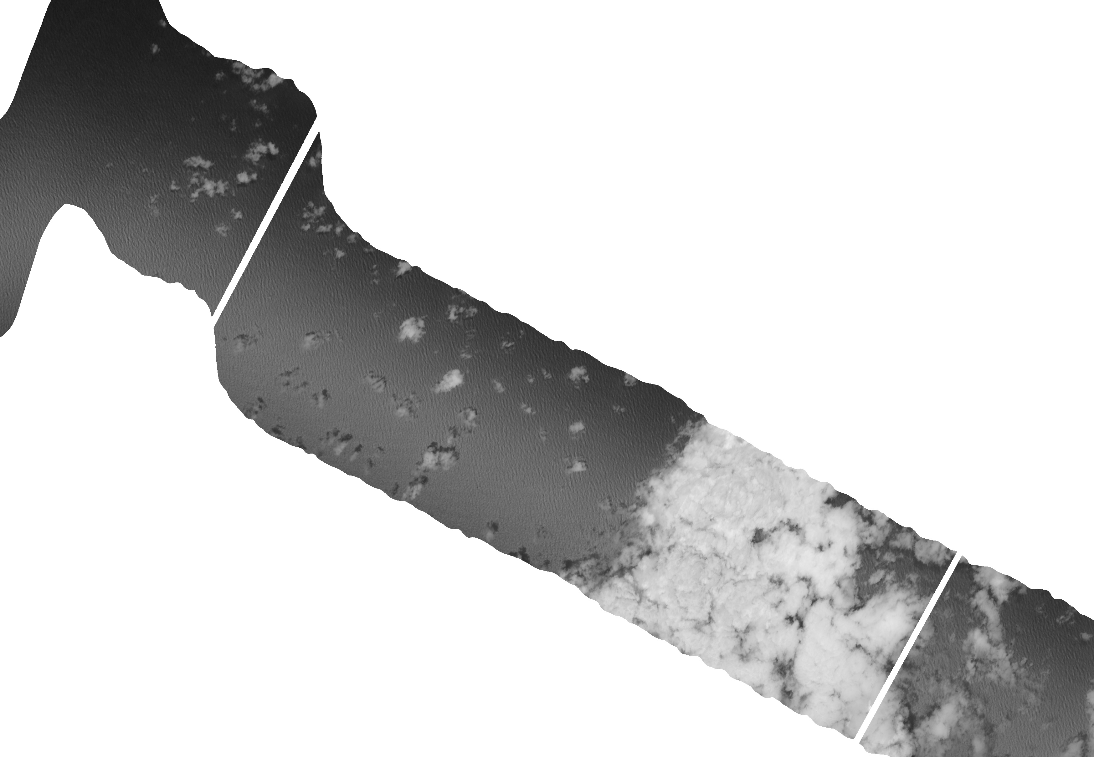
I got caught up with HD(CP)2 meeting in Munich, so I miss my post yesterday. What I really wanted to talk about was specMACS. SpecMACS is the 2D hyperspectral imager that we flew during NARVAL-2, and at the HD(CP)2 meeting I was talking to Tobias about it. SpecMACS is a Downward looking hyper-spectral (400-2500nm) line imager. It consists of two cameras; one that works in the Visible and Near infrared (VNIR, or 0.4-1µm) and the other which work sin the Shortwave and Infrared (1-2.5µm). The hyper-spectra camera’s have a field of view of 35 deg, and about 1000 channels. In addition there is a 2D imaging camera with twice the field of view.
This means that at 9 km, we will see measure a line of 4.6 km across the flight track (assuming the clouds are at 1 km) with the hyperspectral instruments. The SWIR has 320 spatial pixels, so that means a spatial resolution of about 14 m, the VNIR has 4 times that resolution, so a spatial resolution of 3.5 m. The 2D camera has 1000 effective pixels, so a resolution of 7.5m at 8 km.
Consider that for HALO we will fly for about 8hrs at 200 m/s. For the 2D camera we get images of 7.5 km across the flight track, which means we will map out a cloud field of about 210x210 km^2 or a 2x2 deg grid box per flight with better than 10 m resolution. Fantastic.
A taste of this is shown below. The image is from the SWIR at 1.6 µm for RF06 at about 4pm and the 2D camera. When we combine this with the sidewards looking lidar measurements we will get from the ATR it will really be an amazing resolution of the cloud field.
Tobias writes that “the sunglint, present in both cases looks a little different due to the fact that one is a line imager, so the viewing angle does not change along the track, while the other is a 2d imager, looking at different angles at every pixel.”
If you are interested in browsing the specMACS data look here, where you will find quicklooks from NARVAL-II https://macsserver.physik.uni-muenchen.de/campaigns/NARVAL-II/
If you look at the data Tobias suggest that you note "also the general remarks indicated on the site, describing the problems we had with our first downward-looking deployment. Below the section on the single research flights, you will find additional links for some KML-Files which you can use to have a look at the quicklooks in Google Earth.”
Have fun!