2 Feb
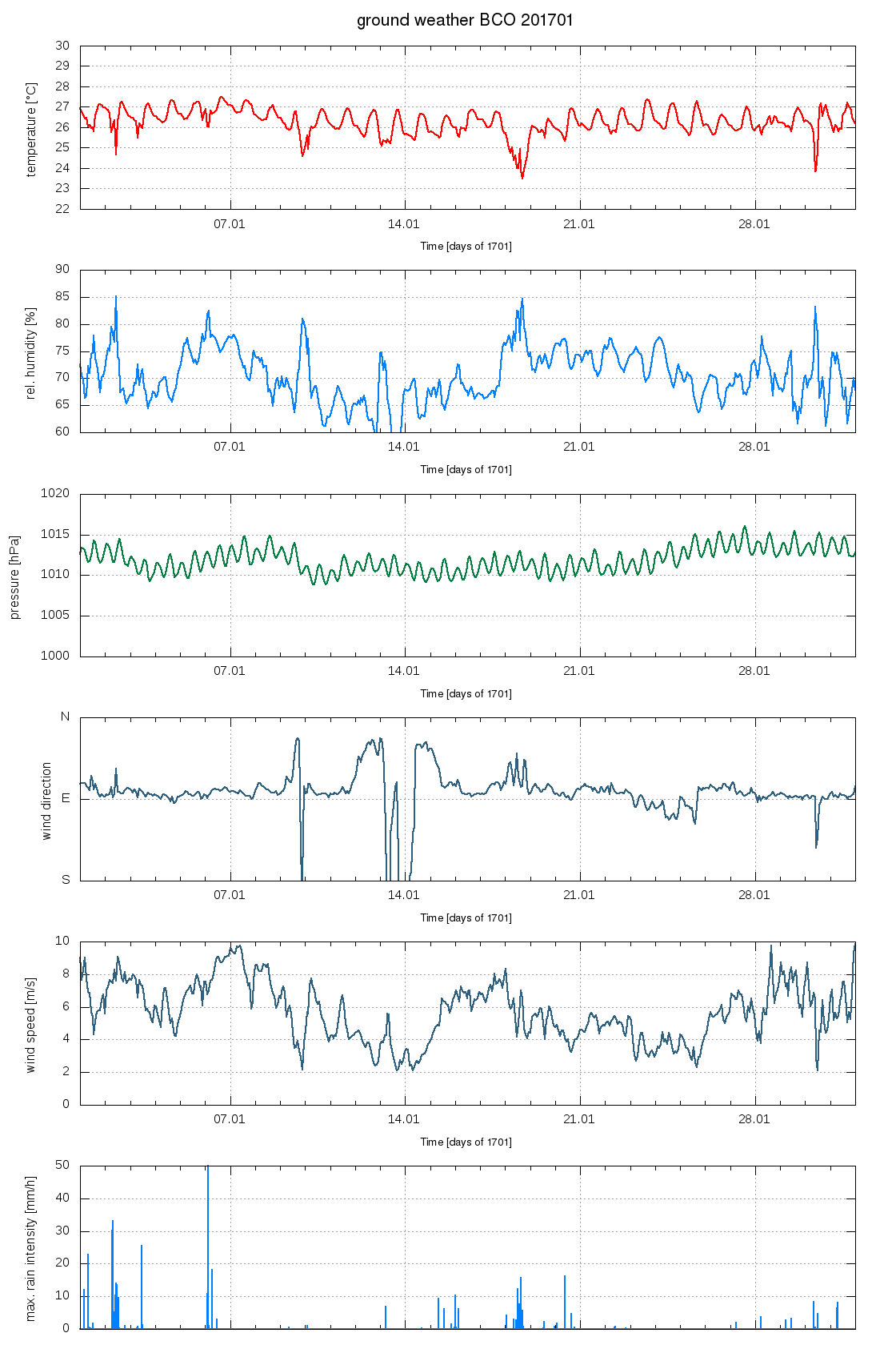
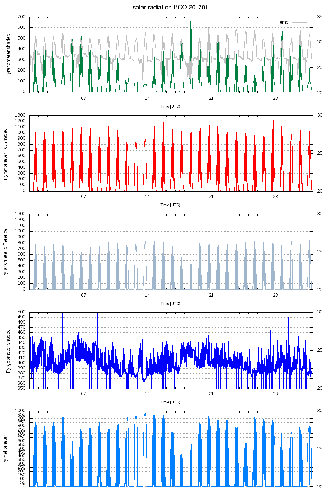
Here are two plots that are on the BCO home page; usually they are posted each month. They shown the monthly time-series of data from the weather station, and from the surface radiation measurements. Looking at the days from the 20th on, i.e., since the start of PreEUREC4A1 it is interesting to contrast the days before the 28th when there was very few clouds to after the clouds on the 28th. Sandrine was wondering if the pickup of much more organized features is evident in the wind-speed; I was skeptical at first, but even by eye on these plots you can pick up a reasonable relationship as the 3 day period before the 28th and a similar period around or before the 14th both had the least cloud development, little evidence of surface precipitation, and the most downwelling solar (look at the pyreheliomometer). I don’t know why I was skeptical, as Louise Nuijen's past work, and also the master’s work of Matthias Brueck emphasised windspeed rain/cloud relationships, and this seems to be in evidence here in periods of slackening winds… one wonders if the slackening of the winds can be translated into stronger divergence. EUREC4A will be able to answer this for us.